


-
History
Evidence of human life on the territory of present-day Turkmenistan started in the Paleolithic Era. Rock inscriptions can be seen in Jebel in the Krasnovodsk Peninsula, and various finds can be observed in the National Museum in Ashgabat.
>>> Read more -
Cooking
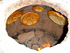
Turkmen cuisine is varied, and includes both meat dishes and soups, and as well as plenty of fruits and vegetables. Bread is a must for every meal.>>> Read more -

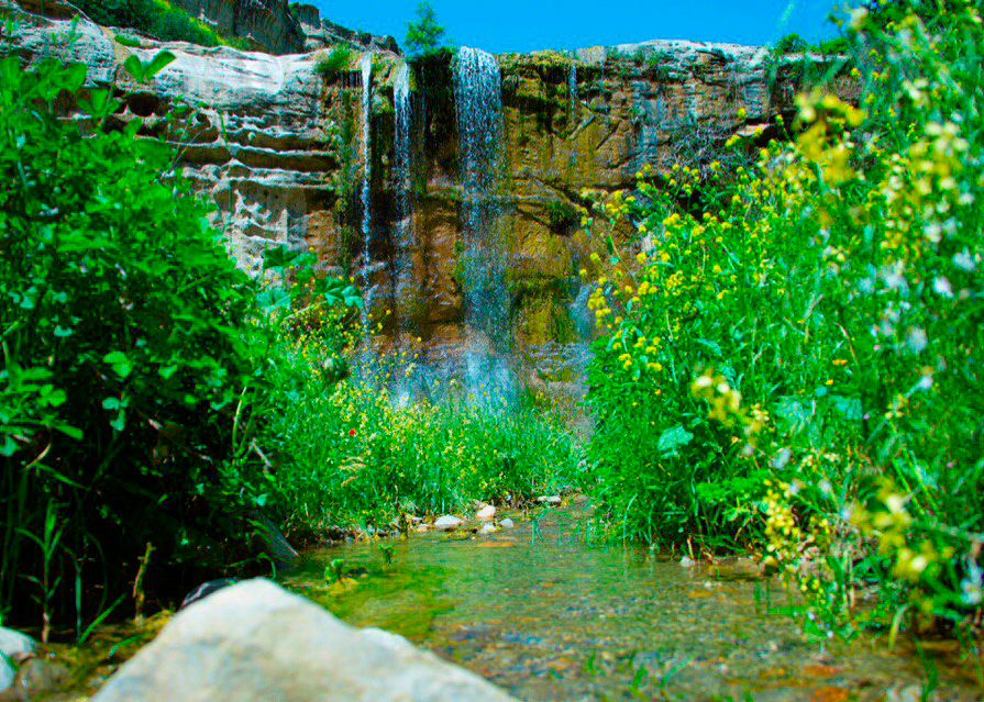
Nature
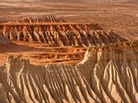
A boring landscape? In actual fact Turkmenistan holds some of the most fascinating diversity of landscapes, from moving sand dunes and limestone cliffs, to lush river valleys and mountains created in the Jurassic period>>> Read more -
Traditions
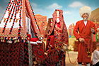
Turkmen are a Turkic-speaking people of nomadic origin (similar to the Kazakhs steppe nomads and the Kyrgyz mountain nomads, and differing from the Persian-speaking Tajiks, or the Turkic-speaking settled Uzbeks).>>> Read more -
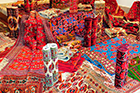
Arts and crafts
Traditional Turkmen women’s garments are real pieces of art. Dresses, overcoats and scarves are made form fine material, woven on simple horizontal looms, and decorated with intricate embroidery, unique in the Central Asian region.>>> Read more -

Ahalteke horses
Experts say that nowhere in the world but in Turkmenistan nature and man’s efforts have succeeded in creating such a graceful, exceptional, tireless, sturdy, noble horse as the Akhal Teke.>>> Read more -

Health
Sun stroke and dehydration are the two main risks to your health in the Turkmen sunshine. A head cover and drinking sufficient fluids (water, juice, soda, tea, soup, etc) will largely protect you against these risks.>>> Read more -
Climate
The climate is sharply continental with little rainfall during summer. Summer is dry. Precipitation is low - about 240 mm a year. With over 250 days of sunshine, Turkmenistan is often called the country of eternal sunshine.>>> Read more -
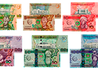
What currency to bring
The national currency is the Turkmen manat. One manat is divided into100 tenge.>>> Read more -

Communication
International telephone calls can be made from most hotels, although prices are very high in comparison to public Call Centers.>>> Read more -

Electricity
In Turkmenistan the standard voltage is 220 V. The standard frequency is 50 Hz. The power sockets that are used are of type C / F. Your need for an adapter depends on the voltage, frequency and power plugs in the country you live in.>>> Read more -
Traveling within Turkmenistan
Turkmenistan airlines operate regular air connections from Ashgabat to five other major Turkmenistan cities (Turkmenabat, Mary, Dashoguz, Turkmenbashi, and Balkanabad).>>> Read more -

Before you go
Bring cash USD bank notes (do not rely on EURO, credit cards or travelers cheques for your local expenses in Turkmenistan; visa, migration tax and vehicle transit costs can be paid in cash USD exclusively)>>> Read more -

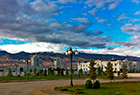
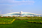
How to get to Turkmenistan
The international airport of Ashgabat is one of Turkmenistan’s major gateways.>>> Read more -
When to Go
Turkmenistan’s climate is extremely continental with hot, dry summers. Midsummer temperature can reach 45 °C. However, such temperatures are quite bearable because of the very low humidity.>>> Read more -

Turkmenistan Visa
In general all foreign nationals are required to have a visa to enter the Republic of Turkmenistan. Tourist visa is issued by the Immigration Service of the Republic of Turkmenistan
>>> Read more